UN
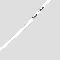
4 Preston Road
£ 355,000
Description
We don't have a Description for this property.
- Bedrooms
- 5
- Bathrooms
- 0


Leaflet © OpenStreetMap contributors
The heatmap indicates the level of crime in the area. The color of the heatmap indicates the crime severity and recency.
Metrics Year-on-Year
- Average area value
- 213,571.00 £Decreased by 10.43 %
- Average area rental value
- 998.00 £/moIncreased by 48.07 %
- Est rental Yield
- 5.61 %Increased by 65.49 %
- Crime Rate
- 1.00 %Unchanged by 0.00 %
from 238,437.00 £
from 674.00 £/mo
from 3.39 %
from 1.00 %
Nearby Schools
| Name | Type | Ofsted | Distance |
|---|---|---|---|
| Holy Family Catholic Primary School | Voluntary Aided School | Good | 0.59 KM |
| Norwood Primary School | Community School | Good | 0.69 KM |
| Holy Trinity Church Of England Primary School, Southport | Academy Converter | 1.56 KM | |
| Arden College | Special Post 16 Institution | Good | 1.60 KM |
| St Philip'S Church Of England Primary School | Voluntary Aided School | Good | 1.62 KM |
Images
Nearby Streets
| Name | Average Price | Average Sqft | Distance |
|---|---|---|---|
| Darwin Court | £ 0 | 0 | 0.00 KM |
| Willow Grove | £ 0 | 0 | 0.00 KM |
| Manchester Road | £ 177,000 | 0 | 0.00 KM |
| Tithebarn Road | £ 120,000 | 0 | 0.00 KM |
| Brompton Road | £ 0 | 0 | 0.00 KM |
Nearby Transport
| Name | NLC | TLC | Distance |
|---|---|---|---|
| Meols Cop | 2357 | MEC | 1.12 KM |
| Southport | 2262 | SOP | 2.26 KM |
| Birkdale | 2352 | BDL | 4.07 KM |
| Hillside | 2231 | HIL | 5.75 KM |
| Bescar Lane | 2351 | BES | 8.25 KM |
Nearby Listings
| Address | Price | Type | Score | Distance |
|---|---|---|---|---|
| Preston Road, Southport | £ 210,000 | BUY | Unknown | 0.01 KM |
| Preston Road, Southport, PR9 | £ 109,500 | BUY | 6 / 10 | 0.01 KM |
| Preston Road, Southport | £ 160,000 | BUY | 6 / 10 | 0.15 KM |
| Cavendish Court, Park Avenue, Southport, PR9 | £ 110,000 | BUY | Unknown | 0.17 KM |
| Roe Lane, Victoria Court, PR9 | £ 270,000 | BUY | 6 / 10 | 0.18 KM |
Nearby Properties
| Address | Price | Distance |
|---|---|---|
| 13a Preston Road | £ 312,500 | 0.00 KM |
| 17a Preston Road | £ 395,000 | 0.00 KM |
| 16 Preston Road | £ 565,000 | 0.00 KM |
| 4a Preston Road | £ 1,000 | 0.00 KM |
| 4 Preston Road | £ 355,000 | 0.00 KM |